Class I Namekagon River, WI
Whispering Pines to McDowell (Whispering Pines Landing to McDowell Bridge Landing)
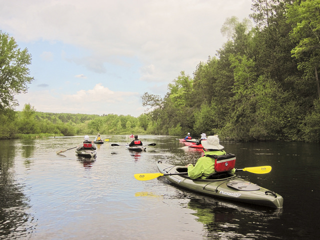
The Namekagon River courses one hundred miles through a mostly forested and rural Wisconsin landscape. It features tight meandering turns and braided stretches around many small islands. The river is generally shallow with a rocky bottom until you near its confluence with the St. Croix where a sandy bottom takes over.
Rapids are found throughout the river rarely reaching Class II. Shallow water near the head of the river makes paddling difficult except early in the season. Be sure to check river levels.
There are several portages around dams. Working dams at Hayward and Trego must be portaged (look for signs) and old dam sites at Pacwawong and Phipps can be run in higher water. Flowages behind these structures mean slower water and boat traffic.
Several small towns sit on the banks north of Trego, Wiscsonsin, lending history and charm to the river character. A wilder landscape can be experienced from County Road K Landing to the St. Croix confluence.
Don't miss the trout fishing on the upper Namekagon. Brown and brook trout live in the colder waters from Larson Road Landing north. The numerous campsites along the entire river make it easy to experience multi-day trips. People enjoy tubing on some stretches of the river, notably between Trout Run Landing and Hayward, and Earl Park Landing to Trego. (Source: National Park Service)
In 1968, 200 miles of the St. Croix National Scenic Riverway, which includes its major tributary the Namekagon, was established as one of the original eight rivers under the Wild and Scenic Rivers Act. In 1972, an additional 27 miles of the lower St. Croix River was the first riverway segment added to the National Wild and Scenic Rivers System by Congress since its inception in 1968. This segment flows along the border of Minnesota and Wisconsin, from Taylor's Falls Dam downstream for 27 miles. This legislation also directed the Secretary of the Interior to add the next 25 miles down to the confluence with the Mississippi River as a state-administered river following application by the governors of Minnesota and Wisconsin (under Section 2(a)(ii) of the Wild and Scenic Rivers Act). This approval was given on June 17, 1976.
For More Information Visit: St. Croix River - rivers.gov
Section Details
| Trip Length | Full Day, 10.1 Miles |
| Fishing | Yes |
| Camping | Yes |
| Permit | No |
| Manager | National Park Service |
| Wild & Scenic | Yes |
| Water Trail | No |
| Partner Information |
http://www.nps.gov/sacn/planyourvisit/whispering-mcdowell.htm
http://wisconsintrailguide.com/paddle/namekagon-river.html |