Class III-IV Chattooga River, SC/GA
Chattooga Section 4 (Highway 76 Bridge Access to Tugaloo Lake Boat Ramp)
Flowing through three states and the Ellicott Rock Wilderness, the Chattooga is recognized as one of the Southeast's premier whitewater rivers. It begins in mountainous North Carolina as small rivulets, nourished by springs and abundant rainfall. High on the slopes of the Appalachian Mountains is the start of a 50-mile journey that ends at Lake Tugaloo between South Carolina and Georgia, dropping almost 1/2-mile in elevation.
The river is one of the few remaining free-flowing streams in the Southeast. The setting is primitive; dense forests and undeveloped shorelines characterize the primitive nature of the area. No motorized vehicles are permitted within a corridor about 1/4-mile wide on either side of the river. Visitors must rely on their own skills and strength rather than on motorized equipment. Man-made facilities are minimal, consisting primarily of hiking trails. (Source: rivers.gov)
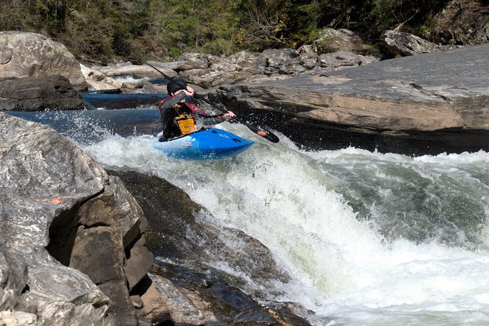
This is the Southeastern Classic! More legends exist about Five Falls of the Chattooga than almost any other set of rapids. Taken individually any of the 5 rapids of Five Falls would be significant named drops on any typical Southeastern river. They are far from the hair found on steep creeks and the legendary danger associated with these rapids arises in part from the long history of boating the Chattooga (40+ years). That said, approach these rapids with caution as they have killed and injured plenty of boaters. (Source: American Whitewater)
For More Information Visit: Chattooga River - rivers.gov
Section Details
| Trip Length | 8.1 Miles |
| Fishing | Yes |
| Camping | Yes |
| Permit | Yes |
| Manager | U.S. Forest Service, Sumter National Forest |
| Wild & Scenic | Yes |
| Water Trail | No |
| Partner Information |
https://www.rivers.gov/river/chattooga
https://www.fs.usda.gov/recarea/scnfs/recarea/?recid=47159 |
| Description | American Whitewater |