Grande Ronde Wild and Scenic River (Wallowa River to Oregon-Washington border)
The Grande Ronde River is located in northeast Oregon and flows through lands that are privately owned and others administered by the Bureau of Land Management and U.S. Forest Service. At 43.8 miles (70.5 km) in length, the federally protected section begins at the confluence with the Wallowa River near Rondowa, and ends near the Oregon-Washington border.
Photo: BLM
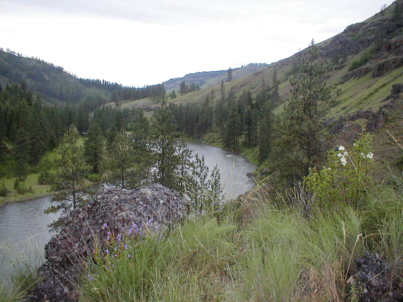
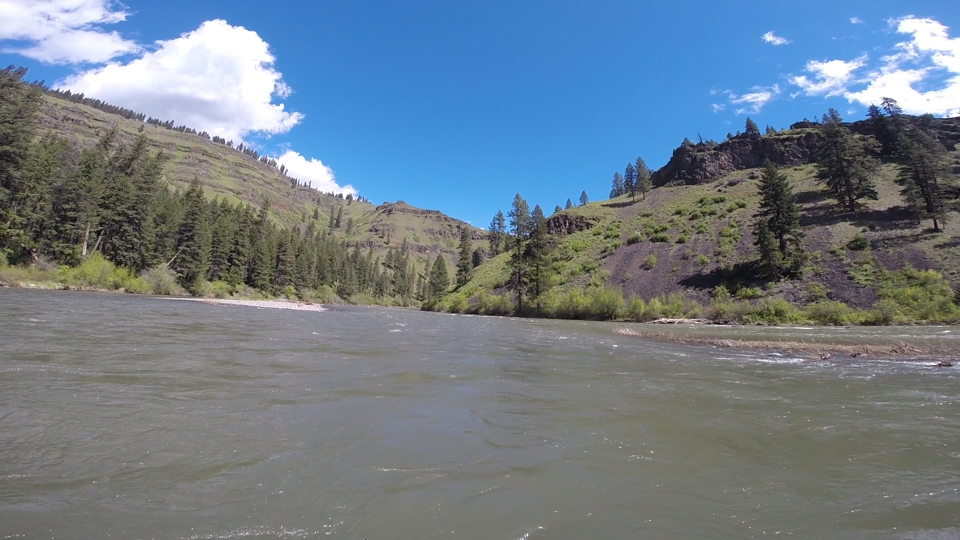
The entire river corridor is a complex ecosystem rich in unique natural features, history, spectacular scenery and a variety of plant and animal life. The 'upper river' consists of steep basalt canyons and ascending ridges within dense evergreen forest, portions of which are only accessible by boat. The meandering curves of the 'middle river' parallel a seldom-traveled county road as the canyon begins to widen and forests yield to open ridges and steep range lands. The 'lower river' section in Washington is characterized by sparsely-vegetated, rugged terrain and contains the history of ancient peoples and pioneer homesteads amongst a few active ranches.
For More Information Visit:Wallowa & Grande Ronde Wild and Scenic Rivers - BLMGrande Ronde River - rivers.gov
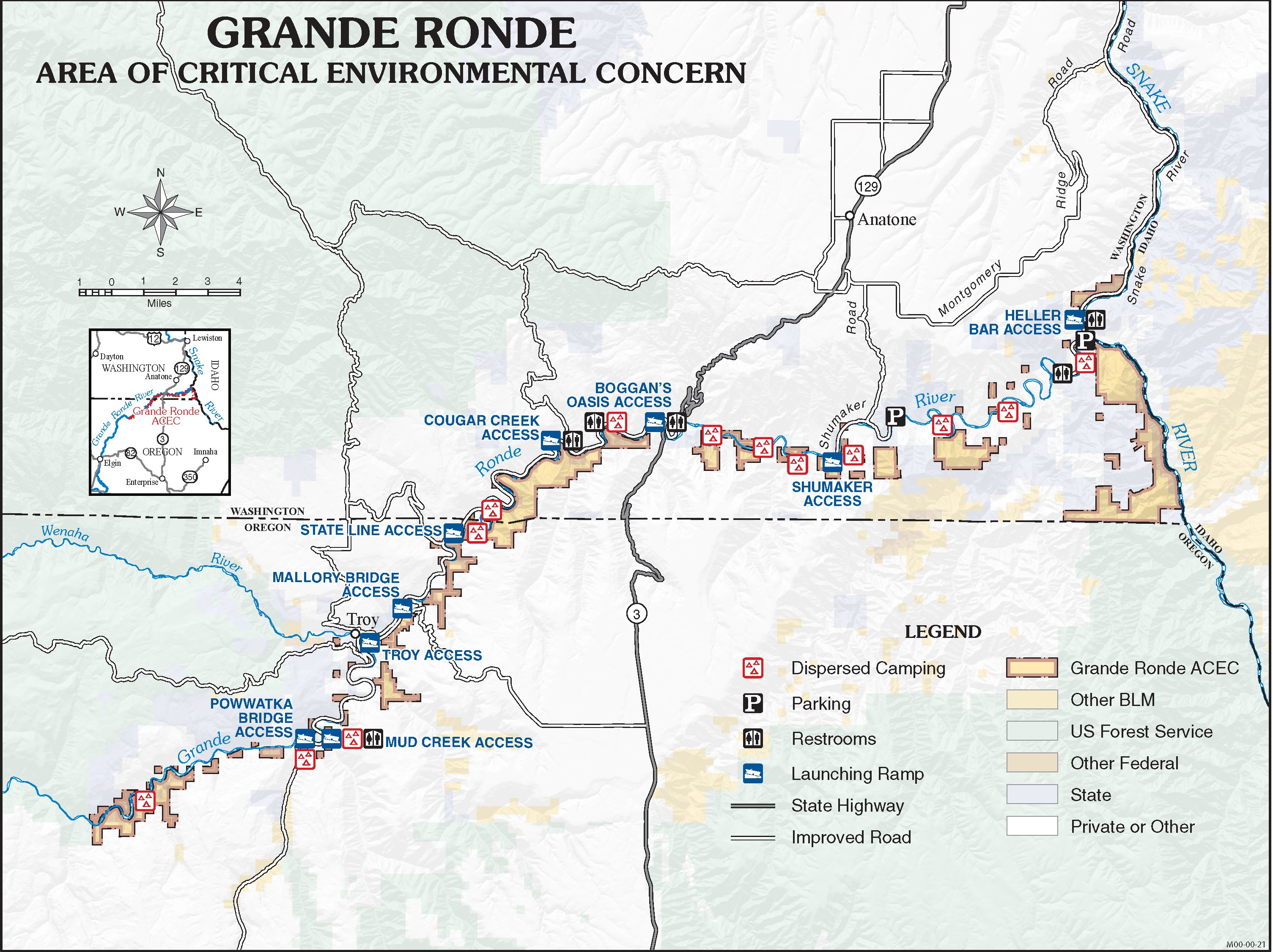
Grande Ronde W&S River Map; BLM
Section Details
Trip Length
Multiday, 43.8 Miles
Notes
Co-Managed by the Forest Service and Oregon State Parks
Fishing
Yes
Camping
Yes
Permit
Yes
Manager
Bureau of Land Management, Vale District Baker Field Office