Crooked Wild and Scenic River - Chimney Rock (1/4-mile downstream from the center crest of Bowman Dam to Dry Creek)
The Crooked River is noted for its ruggedly beautiful scenery, outstanding whitewater boating, and a renowned sport fishery for steelhead, brown trout, and native rainbow trout.
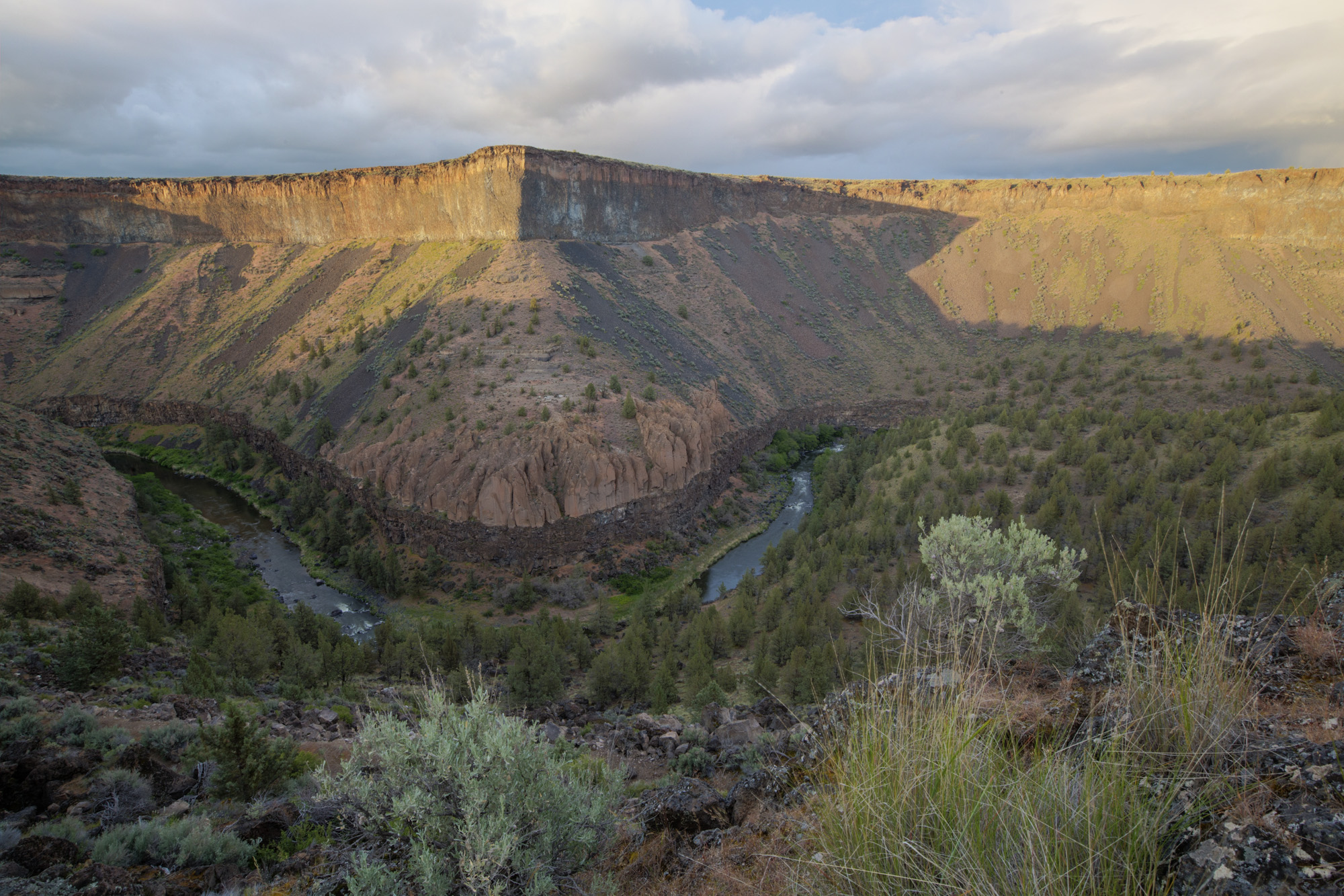
Located in central Oregon, it offers excellent hiking opportunities with spectacular geologic formations and waterfalls. A portion of the designated segment provides expert Class IV-V kayaking/rafting during spring runoff.
The Federally designated Wild and Scenic 8-mile Chimney Rock segment of the Lower Crooked River is located 12 miles south of Prineville, Oregon. The Chimney Rock segment is becoming increasingly popular for the accessibility of outdoor activities.
It contains outstandingly remarkable scenic, recreation, and fish values in addition to its important hydrologic, wildlife, geologic, cultural, vegetation, and ecological resource values.
The river meanders through a very scenic, rugged canyon that includes towering basalt cliffs up to 600 feet high, with scattered western juniper growing on its steep hillsides. State Scenic Highway 27, which is adjacent to the river on the east bank, is also National Backcounty Byway. Several primitive BLM camping areas and the Chimney Rock Recreation Site are also located on the east bank between the highway and the river.
Outstanding fishing opportunities exist for catching rainbow trout, mountain whitefish, and an occasional smallmouth bass. (BLM/BOR)