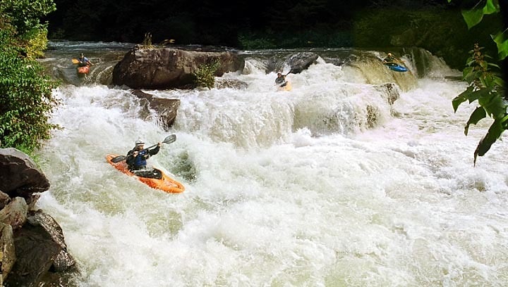
Class IV-V Cheoah River, NC
Cheoah River (Santeetlah Dam to Calderwood Lake Boat Launch)
The Cheoah River is located in the extreme southwestern corner of NC, near Robbinsville. For 77 years the nine-mile section between the Santeetlah Dam and Lake Calderwood was dewatered. American Whitewater along with the Western North Carolina Paddlers advocated for releases for over 6 years. Whitewater releases on the Cheoah began in the fall of 2005. Each year there are at least 18 releases for paddlers to enjoy for the next 40 years.
The Cheoah is unusual for rivers of its volume in the Southeast in that its gradient is relatively constant. This means that with the exception of 2 or 3 half mile or so sections, it is unusually continuous, more so than anything else with a similar volume of water in the Southeast. Some call it "warm western-style paddling;" those paddling it at the higher winter 2002 flows continued the Western analogies, comparing it to Pine Creek on the Arkansas and the Lochsa at high water. No doubt contributing to the analogies was the water quality, which was crystal clear during the winter flows. It has become a classic southeastern run.
American Whitewater worked to restore this river for recreational boating and now paddlers can enjoy 18 days of scheduled whitewater opportunities on this southeast gem.
Learn more about American Whitewater's work here:
Section Details
| Trip Length | Partial Day, 9.3 Miles |
| Fishing | Yes |
| Camping | Yes |
| Manager | U.S. Forest Service, Nantahala National Forest |
| Wild & Scenic | No |
| Water Trail | No |
| Partner Information | https://www.fs.usda.gov/recarea/nfsnc/null/recarea/?recid=48918&actid=70 |
| Description | American Whitewater |