Class III-IV Middle Fork Salmon River, ID
Middle Fork Salmon River (Boundary Creek to Confluence w/Main Salmon)
One of the original eight rivers in the nation designated as wild and scenic on October 2, 1968, the Middle Fork of the Salmon River originates 20 miles northwest of Stanley, Idaho, with the merging of Bear Valley and Marsh Creeks. The entire river, to its confluence with the Salmon River, is designated and is classified as wild, with the exception of a one-mile segment near the Dagger Falls-Boundary Creek Road, which is classified as scenic. All except this short scenic segment is also within the Frank Church River of No Return Wilderness.
The Middle Fork is one of the last free-flowing tributaries of the Salmon River system. Because of its remote location, man’s presence in the area was somewhat limited, leaving it in the condition we see today. Only a few trails, landing strips, private ranches, and U.S. Forest Service stations are evidence of modern society.
The wild river corridor offers a variety of land-based, dispersed, non-motorized activities, including hunting, hiking, camping, and horseback riding.The major trail access into the river corridor is provided by the Middle Fork Trail, beginning at the Boundary Creek launch site. This trail ends at Impassible Canyon. There are a number of trails that extend from the uplands into the river corridor. Trail use is by foot and horse.
Fishing and hunting are the predominant uses in October and November; the fishery is one of the best catch and release fly fisheries in the nation.
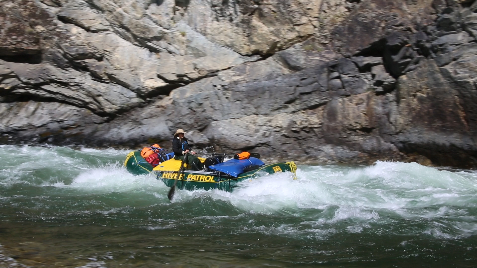
However, it is whitewater boating is what the river is known for; the Middle Fork is internationally recognized for its whitewater/wilderness float trip. The origin of visitors reflects this international renown.
Whitewater boating is by far the predominant use from April through September, with six-day trips the norm. Known for its rugged scenic beauty, quiet isolation, crystal clear water, and the challenge of its whitewater, it is floated by more than 10,000 people each summer. Class III - IV+ rapids offer boating excitement for both families and hard-core adventure types. Hiking from river campsites offers a taste of wilderness, and you may be lucky enough to catch a glimpse of the past and present inhabitants.
The floating activity on the Middle Fork is managed and regulated to preserve the pristine character of the area and experience. Permits to float the river are required all year. The highest use is from May 28 through September 3. This is known as the control season, and permits for this time are allocated through a computerized lottery. Permits for the pre- and/or post-season launch dates that occur outside the lottery control season are also available for reservation beginning on October 1.
Fire pans, portable toilets, ash containers, shovels, buckets, and strainers are required equipment to float the river during any season. Leave No Trace, pack-in, pack-out is the camping ethic mandatory to all camping in the corridor and throughout the entire wilderness. During high use periods, campsites are assigned to boaters at the launch sites.
For More Information Visit: Middle Fork Salmon River - rivers.gov
Section Details
| Trip Length | Multiday, 99.7 Miles |
| Notes | http://www.recreation.gov/wildernessAreaDetails.do?page=detail&contractCode=NRSO&parkId=75534 |
| Fishing | Yes |
| Camping | Yes |
| Permit | Yes |
| Manager | U.S. Forest Service, Salmon-Challis National Forest |
| Wild & Scenic | Yes |
| Water Trail | No |
| Partner Information |
http://www.fs.usda.gov/recarea/scnf/recreation/wateractivities/recarea/?recid=77793&actid=79
https://www.rivers.gov/river/salmon-middle-fork |
| Description | American Whitewater |