Class I Eleven Point River, MO
Thomasville to Highway 142 Bridge
The Eleven Point River has been recognized and loved for its rich history and outstanding scenic beauty since early settlement days. A 44-mile portion of the Eleven Point between Thomasville, Missouri, and the Highway 142 Bridge became one of the eight initial components of the National Wild and Scenic River System in 1968.
About half of the lands within the Eleven Point Scenic River area are private lands, while the remainder of the area is National Forest System land. The private lands along the river are managed by scenic easements to assure protection of their scenic values and natural resources. Public entry of these lands is prohibited. River users should study the river map and be alert for private property or scenic easement signs located along the river course to avoid trespass.
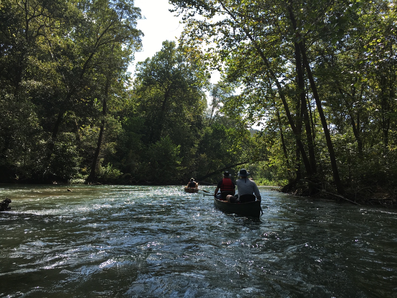
The Eleven Point River meanders through the picturesque Ozark hills of southern Missouri. Its course is cut in the shadows of steep bluffs, through sloping forested valleys and low-lying riparian ecosystems. Barely more than a small stream at its upper reaches near Thomasville, Missouri, it gains considerable width and depth as it proceeds southeastward. Springs pouring from dolomite bluffs or rushing up from a vast network of underground flow systems provide a continuous source of water and beauty.
Alternating stretches of rapids and deep clear pools wind around moss-covered boulders and shading bottomland hardwood trees. River birch is abundant along the shore, and aged sycamores lean out across the river from their shoreline moorings. In some places, the canopy of green closes overhead.
rivers.gov/Eleven Point River
Section Details
| Trip Length | Full Day, 9.7 Miles |
| Fishing | Yes |
| Camping | Yes |
| Permit | No |
| Manager | U.S. Forest Service, Mark Twain National Forest |
| Wild & Scenic | Yes |
| Water Trail | No |
| Partner Information |
http://www.fs.usda.gov/recarea/mtnf/recreation/wateractivities
https://www.rivers.gov/river/eleven-point |