Class II Lamprey River, NH
Route 87 Bridge to Wadleigh Falls
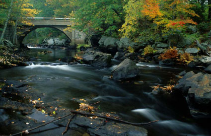
Lamprey River
This quickwater section meanders through largely undeveloped floodplain forest. Blow downs, trees in the river, and log jams are common. Wadleigh Falls/Dam requires portage.
The Lamprey River is a 50 mile-long river in southeastern New Hampshire, the United States. It rises in Meadow Lake in Northwood, and flows south, then generally east past Raymond, Epping, Lee, Durham and finally Newmarket. Here, it meets Great Bay, a tidal inlet of the Atlantic Ocean, to which it is connected by a tidal estuary, the Piscataqua River. The river from the Bunker Pond Dam in Epping to the confluence with the Piscassic River is part of the designated National Wild and Scenic River System. The Lamprey River's natural beauty and diversity offer people many recreational opportunities.
The Lamprey River has a predominantly undeveloped, natural shoreline. As a federally designated Wild and Scenic River, the Lamprey is classified as a "recreational river". Recreational activities along the river are defined mostly by the river itself and access to it. People use the river recreationally for canoeing, kayaking, and swimming in the summer. For fishing enthusiasts, the NH Fish and Game Department stocks brook, brown, and rainbow trout in Lee and Durham and maintains a river herring restoration program on the Lamprey. In winter, visitors to the river enjoy cross country skiing, snowshoeing, skating, and snowmobiling.
Birders, nature enthusiasts, and artists can always find something interesting to observe. The river's scenic quality and natural appearance are clearly major attractions year round. In certain lower reaches of Newmarket, sections of the Lamprey are impounded and deep enough for power boats. Please note, however, that the maximum headway speed is 6 m.p.h.. The river is too narrow for high speeds and its banks are susceptible to erosion caused by wakes.
 Photo : Mark Giuliucci
Many resources exist and are publicly available for users to learn more about the river and the recreational opportunities along it. Please visit www.lampreyriver.org/recreation for more information.
rivers.gov/Lamprey RiverSection Details
| Trip Length | Partial Day, 4.8 Miles |
| Notes | Camping is available at Wadleigh Falls Campground which is a privately-owned facility with river frontage located upstream of Wadleigh Falls |
| Fishing | Yes |
| Camping | Yes |
| Permit | No |
| Manager | Municipal, Lamprey River Advisory Committee |
| Wild & Scenic | Yes |
| Water Trail | No |
| Partner Information |
http://www.lampreyriver.org/UploadedFiles/Files/LampreyTourGuide.pdf
https://www.rivers.gov/river/lamprey |